ArcGIS Maritime 3.2 includes enhancements to facilitate chart production, the creation of depth contours, and database management. Additionally, S-101 data models can now be either flat or subtyped.
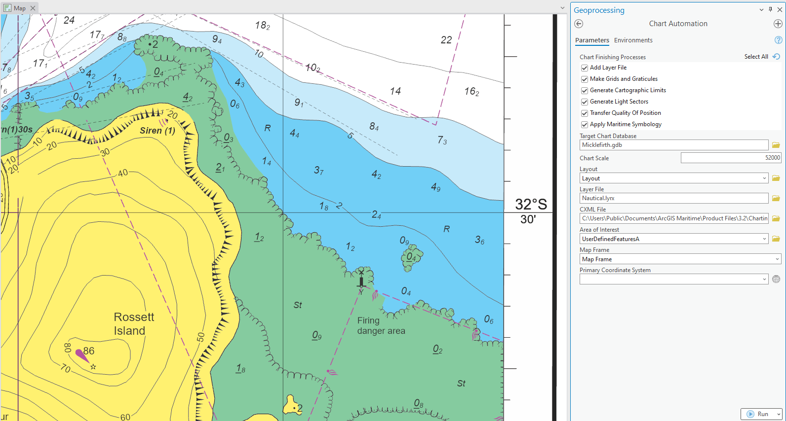
Let’s start with the new charting capabilities. At 3.2, there’s a new Paper Charting toolbox packaged in the ArcGIS Maritime product files. This toolbox contains preconfigured tools that automate chart creation. The first of these is the Chart Automation tool (CAT), which chains together multiple processes to streamline chart production. These processes include the following:
- Adds a Nautical group layer that is ordered and rendered with labels turned on
- Runs the Make Grids and Graticules Layer tool to add grid layers and update the map frame properties
- Runs the Generate Cartographic Limits tool to convert selected features to polylines and generate A_L feature classes
- Generates light sectors based on the AidsToNavigationP point feature class
- Transfers spatial attributes to the feature to aid in symbolization
- Applies maritime symbology based on INT1 symbols

With chart automation, you’ll only have to click Run once to create a paper chart.
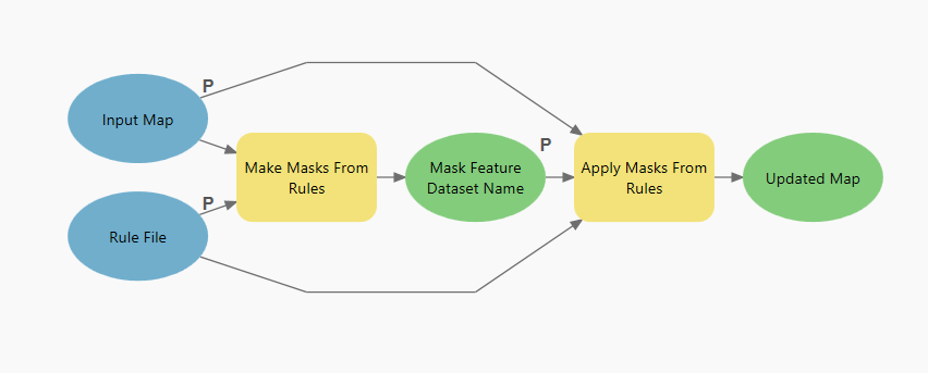
The second tool in the Paper Charting toolbox is Make and Apply Masks from Rules, a model tool that creates and applies feature polygon masks based on color rules.

A preconfigured file containing maritime masking rules is provided in the product files to use with the rules model. Use these two tools in conjunction to create and style paper charts with efficiency.
We’ve also introduced the TIN to Depth Contours tool to automate contour creation, an essential step in generating depth areas. This tool also chains multiple other tools together, and in the process addresses common topological issues, such as short contours, nonsimple geometry, gaps, cutbacks, and collapsed contours.
Generate contours in ArcGIS Pro 3.2
Along with these spiffy new automation tools to ensure your maritime workflows are smooth sailing, support for PostgreSQL database management is also available at 3.2.


Article Discussion: