The act of extracting a cube of the earth, seeing its mass and structure laid bare, removed from its global construct…is just, like, trippy. Here’s a fish tank-like view of the glorious Straits of Mackinac.

Here’s one of the Grampian Mountains of Scotland. I love Scotland.

Here’s a look at the Delmarva peninsula, nestled between the Appalachian mountains in the background and the undersea Continental Rise in the foreground.

While we’re making fish tanks of earth, here’s one of the Seattle/Puget area.

How?
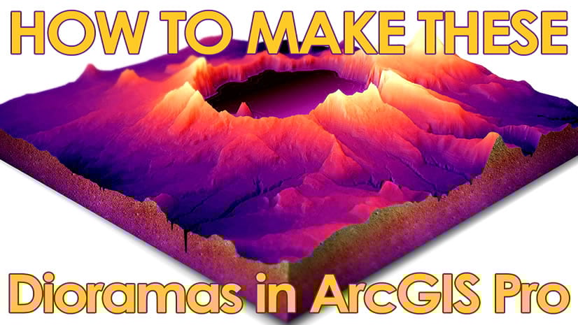
Here’s how you can break out a sharp cartographic edge and extract a charming little cube of the earth, in ArcGIS Pro…
…
00:00 Intro examples
00:24 Nelson nostalgia and diorama intro
02:08 Finding and clipping an elevation model
3:10 Lets go 3D!
4:16 Finding better archived imagery
5:04 Hillshade!
5:29 Water and watery effects
8:38 Arranging a layout and perspective
9:14 Drawing and styling the dirt curtains
11:34 Sneaking in an easter egg
12:48 Labels and title
14:07 Adding a locator map
- Here’s the World Imagery Wayback app to get archived versions of the imagery basemap: https://livingatlas.arcgis.com/wayback
- Source elevation/bathymetry data from the Great Lakes Environmental Research Lab: https://www.glerl.noaa.gov/
- Michigan GIS data portal: https://gis-michigan.opendata.arcgis.com/
- This demo is an extract from a presentation given at the IMAGIN annual conference of lovely Michigan map nerds. https://imagin.org/
- More work from Tau Rho Alpha: https://www.davidrumsey.com/luna/servlet/view/all/who/Alpha%252C%2BTau%2BRho/what/Geology/
- Here’s an alternative process, from Spiros Staridas: https://www.staridasgeography.gr/design-a-beautiful-3d-model-in-arcgis-pro/
Why?
Why would seeing a landscape fully removed from its environment—sliced out and dropped into empty space for examination—engage our curiosity and delight in a way that a standard whole landscape doesn’t? There are pragmatic reasons, sure, like opportunity to see some geological cross-sections. But I didn’t add any meaningful geological cross sections in these examples (unless you count the fossils I snuck in). I think when we see a diorama like this it echoes in our minds that what we are seeing is an intricate scale model. It becomes its own thing, rather than a snapshot of the actual thing. When a map perspective becomes enthingified like this, it brings along its own, however small, sense of mass and gravity. An entity in itself, rather than a facsimile of reality. And somehow when we feel we’re looking at a miniaturized extract of earth we can borrow that energy towards feeling that way about the whole earth. The earth, by extension, becomes enthingified.
A fish tank is a cube of water and gravel and creatures, at a scale we can wrap our arms and minds around. But a fish tank, as a small extract of the vast and complex chaos of the global ocean, bridges our sense of scale and lets us wonder and admire the whole. Via the portion.
I hope you give this sort of map a try. It’s terribly fun and the results, and how you feel about them, might surprise you.
Love, John


Article Discussion: